Eleanor Cross plaque
Introduction
The photograph on this page of Eleanor Cross plaque by Richard Croft as part of the Geograph project.
The Geograph project started in 2005 with the aim of publishing, organising and preserving representative images for every square kilometre of Great Britain, Ireland and the Isle of Man.

There are currently over 7.5m images from over 14,400 individuals and you can help contribute to the project by visiting https://www.geograph.org.uk
Eleanor Cross plaque
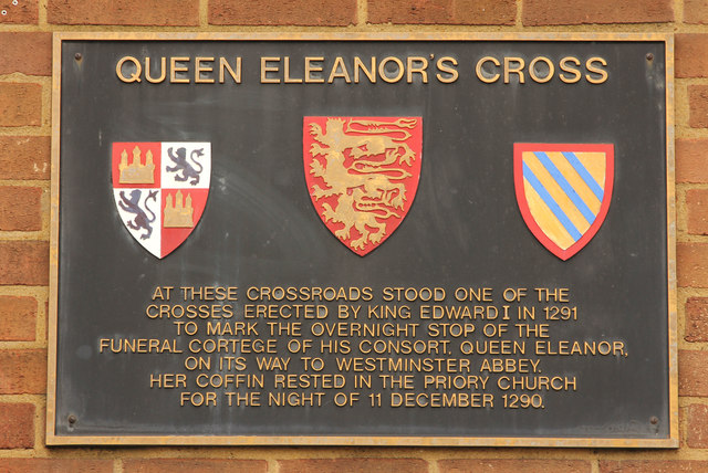
Image: © Richard Croft Taken: 4 Sep 2014
Plaque on the Nat West bank on the High Street crossroads with West Street and Church Street http://www.geograph.org.uk/photo/4022613 indicating the site of Dunstable Eleanor Cross. Following her death in Harby on 28th November 1290, Queen Eleanor’s funeral cortège stopped overnight at the nearby Dunstable Priory en-route to Westminster Abbey. King Edward I erected a memorial cross at each of the 12 overnight stops, only three survive, at Geddington, Hardingstone and Waltham. Dunstable Priory provided accommodation for the overnight stay of the funeral cortège in 1290 and a site for the cross was chosen the following morning, in the market place where Watling Street meets Icknield Way near the entrance to Church Street. The cross was demolished by the Parliamentarian troops of the Earl of Essex in 1643.
Images are licensed for reuse under creativecommons.org/licenses/by-sa/2.0
Image Location
Latitude
51.886179
Longitude
-0.521124