Blackpool
Introduction
The photograph on this page of Blackpool by Derek Harper as part of the Geograph project.
The Geograph project started in 2005 with the aim of publishing, organising and preserving representative images for every square kilometre of Great Britain, Ireland and the Isle of Man.

There are currently over 7.5m images from over 14,400 individuals and you can help contribute to the project by visiting https://www.geograph.org.uk
Blackpool
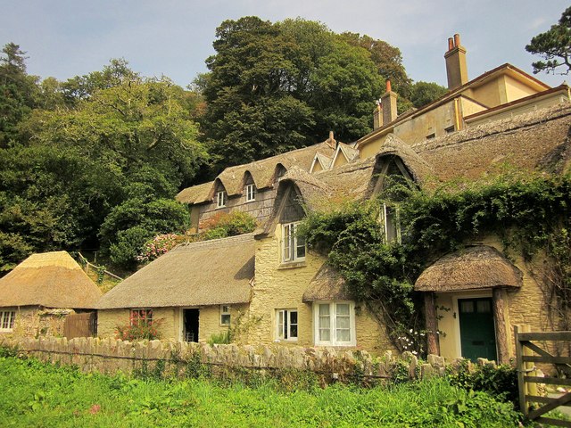
Image: © Derek Harper Taken: 5 Sep 2014
A closer view of the houses shown in Image Closest to the camera is Blackpool Cottage including outbuilding http://list.english-heritage.org.uk/resultsingle.aspx?uid=1107988&searchtype=mapsearch , "converted from a pair of ... 1-room plan cottages ... with reed applied to the tympana of the gables above". Above is Blackpool House - the house to the right dates from the 1830s, while the adjoining cottage is later, and features "walls faced in vertically applied water reeds fixed by horizontal buttons". Also listed is the thatched outbuilding on the extreme left http://list.english-heritage.org.uk/resultsingle.aspx?uid=1164440&searchtype=mapsearch , "of uncertain use". Seen from the coast path beside the point where it crosses the A379.
Images are licensed for reuse under creativecommons.org/licenses/by-sa/2.0
Image Location


Leaflet Map data © OpenStreetMap
Latitude
50.320116
Longitude
-3.612382