1GL Bolt: Grainthorpe, Church
Introduction
The photograph on this page of 1GL Bolt: Grainthorpe, Church by Brian Westlake as part of the Geograph project.
The Geograph project started in 2005 with the aim of publishing, organising and preserving representative images for every square kilometre of Great Britain, Ireland and the Isle of Man.

There are currently over 7.5m images from over 14,400 individuals and you can help contribute to the project by visiting https://www.geograph.org.uk
1GL Bolt: Grainthorpe, Church
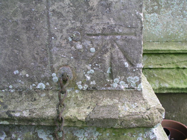
Image: © Brian Westlake Taken: 30 Nov 2007
Cut bench mark with bolt alongside, but now cemented over, located on the north-west angle of the tower. It was part of the Swineshead to Rawcliffe levelling line surveyed in the 1850s as part of the First Geodetic Levelling of England. See http://www.bench-marks.org.uk/bm24786 for details.
Images are licensed for reuse under creativecommons.org/licenses/by-sa/2.0
Image Location
Latitude
53.447633
Longitude
0.087766