Gt Victoria Street Baptist church (demolition) - September 2014(3)
Introduction
The photograph on this page of Gt Victoria Street Baptist church (demolition) - September 2014(3) by Albert Bridge as part of the Geograph project.
The Geograph project started in 2005 with the aim of publishing, organising and preserving representative images for every square kilometre of Great Britain, Ireland and the Isle of Man.

There are currently over 7.5m images from over 14,400 individuals and you can help contribute to the project by visiting https://www.geograph.org.uk
Gt Victoria Street Baptist church (demolition) - September 2014(3)
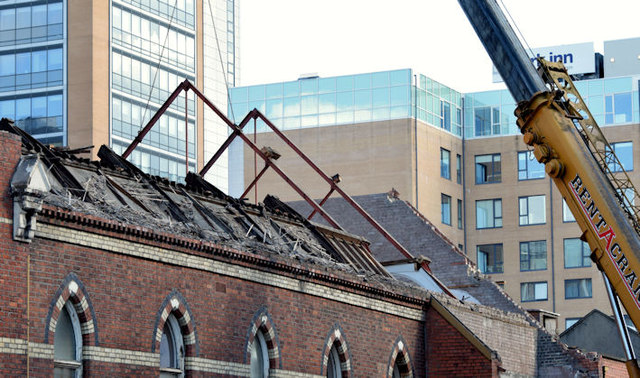
Image: © Albert Bridge Taken: 7 Sep 2014
The Hope Street side of the church where the roof trusses are being supported by a road crane, before demolition.
Images are licensed for reuse under creativecommons.org/licenses/by-sa/2.0
Image Location
Latitude
54.593345
Longitude
-5.933988