Ashton Canal
Introduction
The photograph on this page of Ashton Canal by Gerald England as part of the Geograph project.
The Geograph project started in 2005 with the aim of publishing, organising and preserving representative images for every square kilometre of Great Britain, Ireland and the Isle of Man.

There are currently over 7.5m images from over 14,400 individuals and you can help contribute to the project by visiting https://www.geograph.org.uk
Ashton Canal
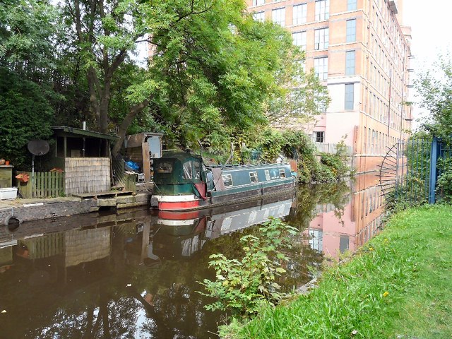
Image: © Gerald England Taken: 5 Sep 2014
Approaching the Asda tunnel. In the background is Cavendish Mill, now converted in apartments. The moored narrowboat appears to originally have come from the Melbourne Basin (which is on the Pocklington Canal) but its name appears to have been painted over.
Images are licensed for reuse under creativecommons.org/licenses/by-sa/2.0
Image Location
Latitude
53.483359
Longitude
-2.097761