
Haslingfield: the Wellhouse
Introduction
The photograph on this page of Haslingfield: the Wellhouse by John Sutton as part of the Geograph project.
The Geograph project started in 2005 with the aim of publishing, organising and preserving representative images for every square kilometre of Great Britain, Ireland and the Isle of Man.

There are currently over 7.5m images from over 14,400 individuals and you can help contribute to the project by visiting https://www.geograph.org.uk
Haslingfield: the Wellhouse
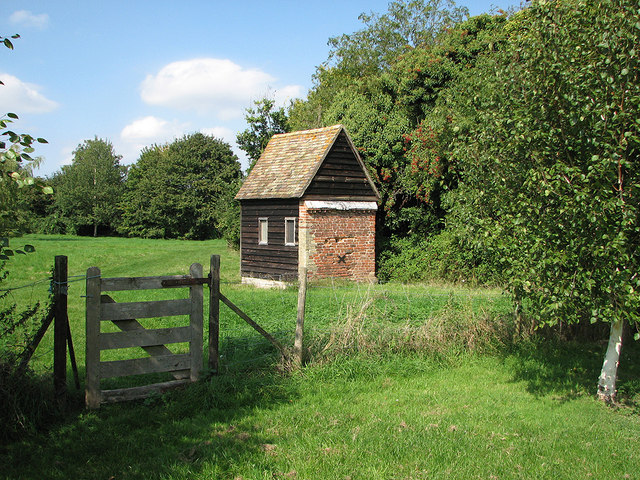
Image: © John Sutton Taken: 7 Sep 2014
Wellhouse Meadow is one of two surviving fragments of the Saxon Great Green. It was acquired by the Parish Council in 1976, to be held in perpetuity as a village amenity. The brick parts of the wellhouse date from the 17th century and the wooden parts were renovated in 1978. The well inside is 2m wide, but blocked with fallen masonry, so its depth is unknown. Remains of its hand pump survive. The fence separates the main part of the meadow from the dog-free section in which I stood to take the picture.
Images are licensed for reuse under creativecommons.org/licenses/by-sa/2.0
Image Location

Latitude
52.151031
Longitude
0.051854