Conversion of former Highways Services building
Introduction
The photograph on this page of Conversion of former Highways Services building by John Baker as part of the Geograph project.
The Geograph project started in 2005 with the aim of publishing, organising and preserving representative images for every square kilometre of Great Britain, Ireland and the Isle of Man.

There are currently over 7.5m images from over 14,400 individuals and you can help contribute to the project by visiting https://www.geograph.org.uk
Conversion of former Highways Services building
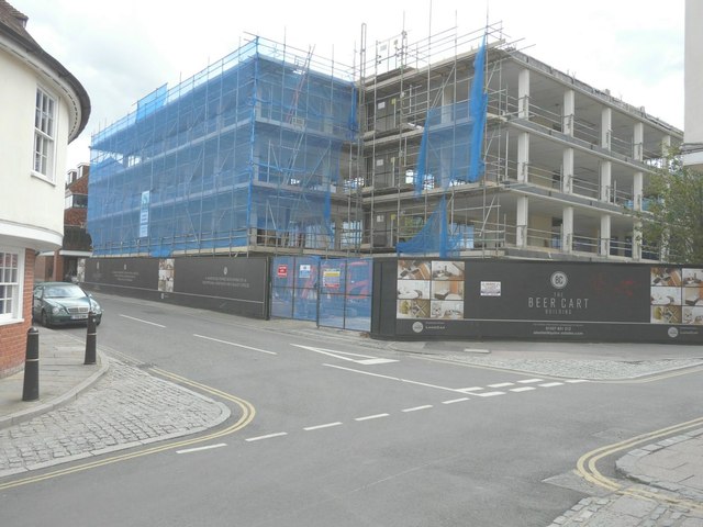
Image: © John Baker Taken: 24 Aug 2014
Planning permission has been granted by Canterbury City Council under application number CA//13/00301 for the “conversion, extension and modernisation of the existing office blocks for the retention of Class B1a office floor space and a residential development of 14 two bedroom apartments, plus associated car parking, landscaping and infrastructure”. Its address is 2 Beer Cart Lane (to the left) and 70 Stour Street (to the right). Before building work started, it appeared as Image
Images are licensed for reuse under creativecommons.org/licenses/by-sa/2.0
Image Location
Latitude
51.278054
Longitude
1.077297