Dalliefour Farm
Introduction
The photograph on this page of Dalliefour Farm by Anne Burgess as part of the Geograph project.
The Geograph project started in 2005 with the aim of publishing, organising and preserving representative images for every square kilometre of Great Britain, Ireland and the Isle of Man.

There are currently over 7.5m images from over 14,400 individuals and you can help contribute to the project by visiting https://www.geograph.org.uk
Dalliefour Farm
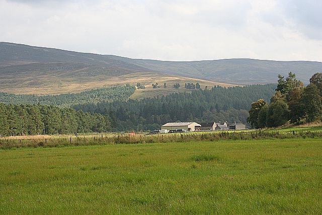
Image: © Anne Burgess Taken: 3 Sep 2014
The farm stands on one of the former flood plains of the River Dee, now well above the level of the river, which has cut down through its former levels. In the background is part of the ridge to the south of the Dee Valley.
Images are licensed for reuse under creativecommons.org/licenses/by-sa/2.0
Image Location
Latitude
57.042325
Longitude
-3.058169