Zebra crossing near Dawes Close, Clevedon
Introduction
The photograph on this page of Zebra crossing near Dawes Close, Clevedon by Jaggery as part of the Geograph project.
The Geograph project started in 2005 with the aim of publishing, organising and preserving representative images for every square kilometre of Great Britain, Ireland and the Isle of Man.

There are currently over 7.5m images from over 14,400 individuals and you can help contribute to the project by visiting https://www.geograph.org.uk
Zebra crossing near Dawes Close, Clevedon
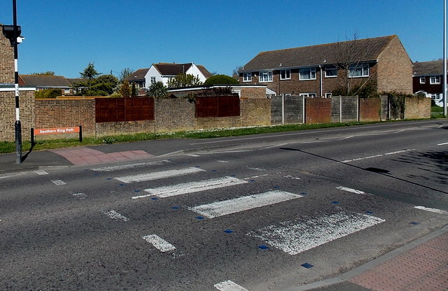
Image: © Jaggery Taken: 14 Apr 2014
The name sign on the far side of the crossing shows Southern Ring Path. Although Belisha beacons had marked pedestrian crossings in the UK from 1934, it was not until 1951 that the now familiar black and white stripes stretching across the width of the road were officially introduced. Previously, there were only metal studs across the road surface.
Images are licensed for reuse under creativecommons.org/licenses/by-sa/2.0
Image Location
Latitude
51.42634
Longitude
-2.854307