Rheola Bridge, Porth
Introduction
The photograph on this page of Rheola Bridge, Porth by Roger Cornfoot as part of the Geograph project.
The Geograph project started in 2005 with the aim of publishing, organising and preserving representative images for every square kilometre of Great Britain, Ireland and the Isle of Man.

There are currently over 7.5m images from over 14,400 individuals and you can help contribute to the project by visiting https://www.geograph.org.uk
Rheola Bridge, Porth
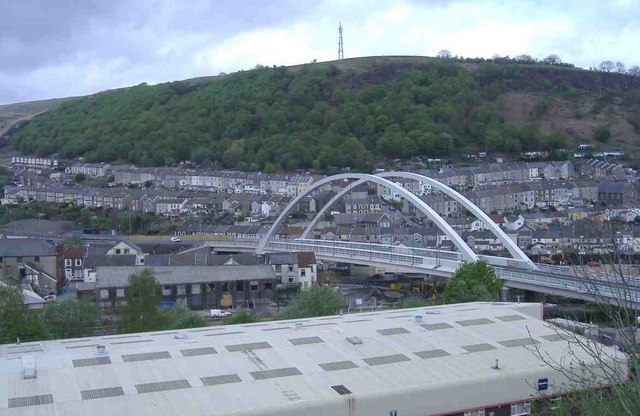
Image: © Roger Cornfoot Taken: 25 Apr 2007
The new relief road scheme for Porth includes eight kilometres of new and improved roads and ten bridges. A landmark feature is the bow string arched Rheola Bridge passing over the two Rhondda rivers, the Treherbert railway line, and the existing A4233 - just north of the town centre.
Images are licensed for reuse under creativecommons.org/licenses/by-sa/2.0
Image Location
Latitude
51.614646
Longitude
-3.411153