Waste scree
Introduction
The photograph on this page of Waste scree by Jonathan Wilkins as part of the Geograph project.
The Geograph project started in 2005 with the aim of publishing, organising and preserving representative images for every square kilometre of Great Britain, Ireland and the Isle of Man.

There are currently over 7.5m images from over 14,400 individuals and you can help contribute to the project by visiting https://www.geograph.org.uk
Waste scree
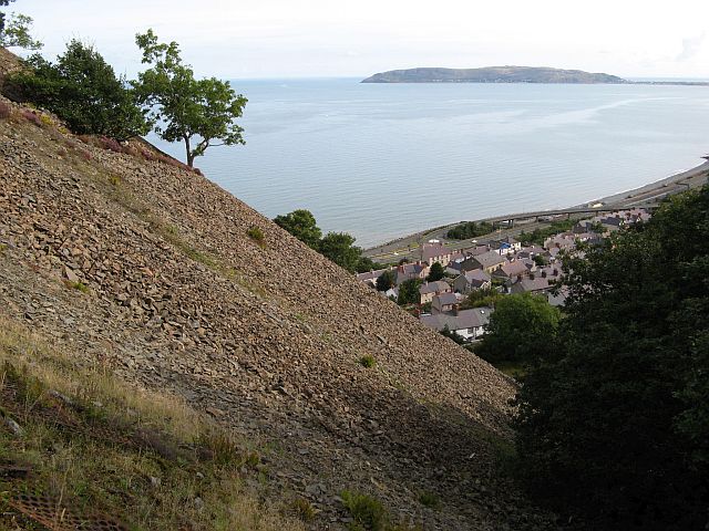
Image: © Jonathan Wilkins Taken: 24 Aug 2014
Waste material was traditionally simply tipped over the side of the quarry levels - notwithstanding the risk to housing and road users below. Nowadays much of the area has been cleaned up and seeded, or simply overgrown with scrub - but not here. This path was a route for workers at Brundrit's quarries from their company housing in Penmaenan below. Note the collapsed fencing made with scrap lengths of steel screen from the crushing and screening plant supported on scrap rail from the tramways.
Images are licensed for reuse under creativecommons.org/licenses/by-sa/2.0
Image Location
Latitude
53.266591
Longitude
-3.936698