St Illtud Church, Upper Church Village
Introduction
The photograph on this page of St Illtud Church, Upper Church Village by Roger Cornfoot as part of the Geograph project.
The Geograph project started in 2005 with the aim of publishing, organising and preserving representative images for every square kilometre of Great Britain, Ireland and the Isle of Man.

There are currently over 7.5m images from over 14,400 individuals and you can help contribute to the project by visiting https://www.geograph.org.uk
St Illtud Church, Upper Church Village
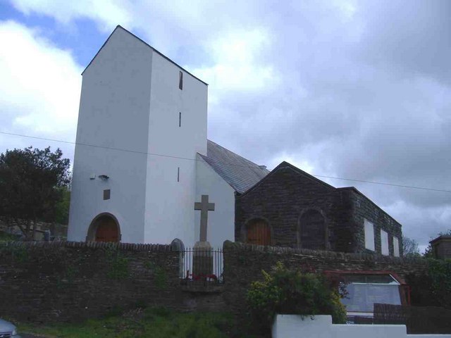
Image: © Roger Cornfoot Taken: 25 Apr 2007
St Illtud Parish Church is on a site that has been used for worship since the fifth century although the present building only dates from the sixteenth century. The tower dates from 1636; the register from 1632, whilst the bell was cast during the nineteenth century. It was restored and rededicated in 1974.
Images are licensed for reuse under creativecommons.org/licenses/by-sa/2.0
Image Location
Latitude
51.570953
Longitude
-3.325676