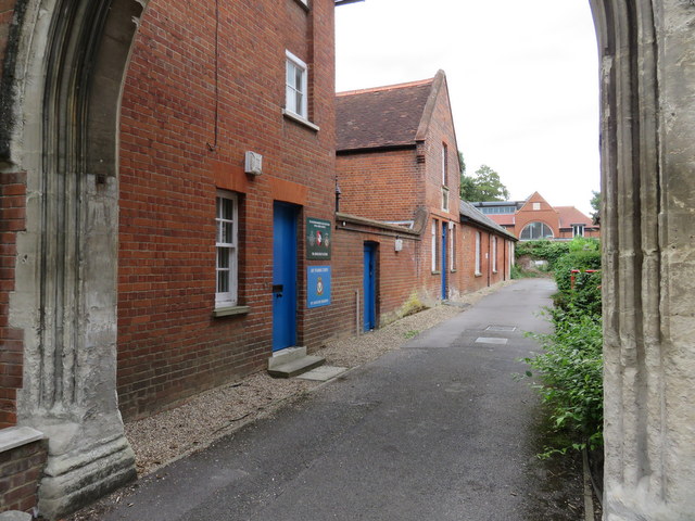
Marlow Drill Hall
Introduction
The photograph on this page of Marlow Drill Hall by John S Turner as part of the Geograph project.
The Geograph project started in 2005 with the aim of publishing, organising and preserving representative images for every square kilometre of Great Britain, Ireland and the Isle of Man.
There are currently over 7.5m images from over 14,400 individuals and you can help contribute to the project by visiting https://www.geograph.org.uk

Image: © John S Turner Taken: 18 Aug 2014
Looking down the lane away from Institute Road, between the former Institute on the right, and the former HQ of the 1st Bucks Rifle Volunteer Corps. http://www.lightbobs.com/a-brief-history.html on the left, which was built in 1889 - as recorded on the foundation stone. The Drill Hall itself, which is the low building towards the end of the lane, beyond the second tall building, was built in the early 20th century, first appearing on the 1926 O.S. map. Later it was the HQ of the Oxfordshire & Buckinghamshire Light Infantry (A Company), and in 2014 the signs outside refer to The Buckinghamshire Cadet Battalion Royal Green Jackets 12th (Marlow) Platoon and Air Training Corps 1811 (Marlow) Squadron http://1811atc.org.uk/

