King George V Playing Field Commemoration (b)
Introduction
The photograph on this page of King George V Playing Field Commemoration (b) by Basher Eyre as part of the Geograph project.
The Geograph project started in 2005 with the aim of publishing, organising and preserving representative images for every square kilometre of Great Britain, Ireland and the Isle of Man.

There are currently over 7.5m images from over 14,400 individuals and you can help contribute to the project by visiting https://www.geograph.org.uk
King George V Playing Field Commemoration (b)
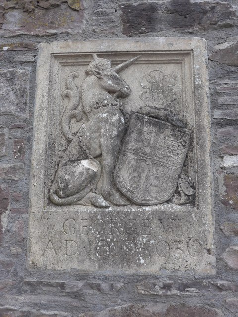
Image: © Basher Eyre Taken: 13 Aug 2014
As a memorial to King George V after his death in 1936, a foundation was established to give capital grants to towns and villages for the provision of playing fields: "any open space used for the purpose of outdoor games, sports and pastimes." All sites were to be called 'King George’s Field' and distinguished by heraldic panels that were usually displayed at a specially designed entrance. 471 schemes in the UK received grants from the Foundation. In 1965 the responsibility for establishing and preserving King George's Fields passed to the National Playing Fields Association. http://en.wikipedia.org/wiki/King_George's_Fields
Images are licensed for reuse under creativecommons.org/licenses/by-sa/2.0
Image Location
Latitude
56.365907
Longitude
-3.853156