Totnes United Free Church
Introduction
The photograph on this page of Totnes United Free Church by Jaggery as part of the Geograph project.
The Geograph project started in 2005 with the aim of publishing, organising and preserving representative images for every square kilometre of Great Britain, Ireland and the Isle of Man.

There are currently over 7.5m images from over 14,400 individuals and you can help contribute to the project by visiting https://www.geograph.org.uk
Totnes United Free Church
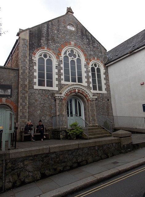
Image: © Jaggery Taken: 5 Jul 2014
Set back from the south side of Fore Street in the town centre. The datestone near the top of the facade shows 1877, when the church opened as a Baptist Church. Totnes United Free Church remains part of The Baptist Union of Great Britain.
Images are licensed for reuse under creativecommons.org/licenses/by-sa/2.0
Image Location
Latitude
50.431224
Longitude
-3.686134