
Avenue of lime trees leading to Eresby House
Introduction
The photograph on this page of Avenue of lime trees leading to Eresby House by Chris as part of the Geograph project.
The Geograph project started in 2005 with the aim of publishing, organising and preserving representative images for every square kilometre of Great Britain, Ireland and the Isle of Man.

There are currently over 7.5m images from over 14,400 individuals and you can help contribute to the project by visiting https://www.geograph.org.uk
Avenue of lime trees leading to Eresby House
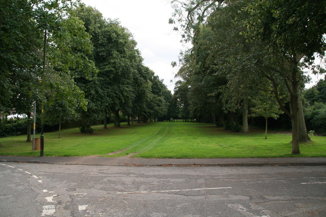
Image: © Chris Taken: 19 Aug 2014
The avenue is intersected by the new A16 past Spilsby, where this section ends. A local woman I asked had no idea of what it was, except the way to the sports ground (at first I thought it must be a disused railway). From the map all is clear. The road behind the camera, of which it is a continuation, is called Eresby Avenue, which I suppose should have been a clue!
Images are licensed for reuse under creativecommons.org/licenses/by-sa/2.0
Image Location

Latitude
53.171693
Longitude
0.089156