St Mary's Home electricity substation in Painswick
Introduction
The photograph on this page of St Mary's Home electricity substation in Painswick by Jaggery as part of the Geograph project.
The Geograph project started in 2005 with the aim of publishing, organising and preserving representative images for every square kilometre of Great Britain, Ireland and the Isle of Man.

There are currently over 7.5m images from over 14,400 individuals and you can help contribute to the project by visiting https://www.geograph.org.uk
St Mary's Home electricity substation in Painswick
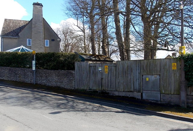
Image: © Jaggery Taken: 23 Mar 2014
The identifier on the Central Networks electricity substation is ST MARY'S HOME 10456. Environmental awareness labels on the wooden enclosure state that the equipment is registered as PCB contaminated (less than 0.05% by weight). PCB is polychlorinated biphenyl.
Images are licensed for reuse under creativecommons.org/licenses/by-sa/2.0
Image Location
Latitude
51.783817
Longitude
-2.196524