Remains of railway bridge
Introduction
The photograph on this page of Remains of railway bridge by Bikeboy as part of the Geograph project.
The Geograph project started in 2005 with the aim of publishing, organising and preserving representative images for every square kilometre of Great Britain, Ireland and the Isle of Man.

There are currently over 7.5m images from over 14,400 individuals and you can help contribute to the project by visiting https://www.geograph.org.uk
Remains of railway bridge
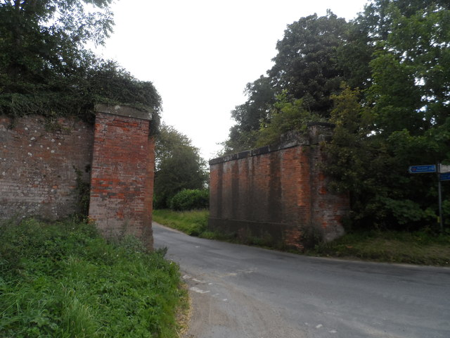
Image: © Bikeboy Taken: 18 Aug 2014
The bridge carried the Wymondham to Wells branch line. The line opened between 1847 and 1857. This section closed to passengers in and freight in 1964. The line was at its busiest during WW2 when it was used to transport materials needed for the construction of East Anglian military airfields.
Images are licensed for reuse under creativecommons.org/licenses/by-sa/2.0
Image Location
Latitude
52.776681
Longitude
0.943103