Northampton: St Giles
Introduction
The photograph on this page of Northampton: St Giles by John Sutton as part of the Geograph project.
The Geograph project started in 2005 with the aim of publishing, organising and preserving representative images for every square kilometre of Great Britain, Ireland and the Isle of Man.

There are currently over 7.5m images from over 14,400 individuals and you can help contribute to the project by visiting https://www.geograph.org.uk
Northampton: St Giles
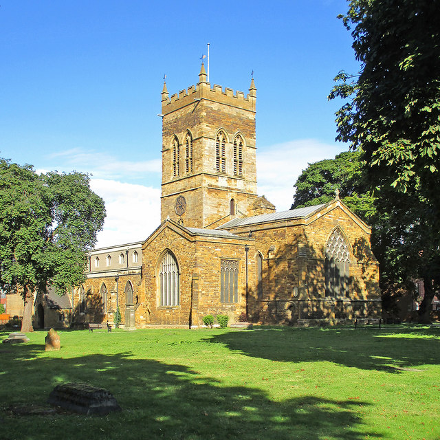
Image: © John Sutton Taken: 16 Aug 2014
"The dominant element is the tall crossing tower. This is Norman, but its upper parts fell in 1613 and were rebuilt in 1616. The top was again renewed in 1914 ... The big E window has C19 tracery" (Nikolaus Pevsner).
Images are licensed for reuse under creativecommons.org/licenses/by-sa/2.0
Image Location
Latitude
52.238005
Longitude
-0.889638