View from the Highlandman's Road
Introduction
The photograph on this page of View from the Highlandman's Road by Lairich Rig as part of the Geograph project.
The Geograph project started in 2005 with the aim of publishing, organising and preserving representative images for every square kilometre of Great Britain, Ireland and the Isle of Man.

There are currently over 7.5m images from over 14,400 individuals and you can help contribute to the project by visiting https://www.geograph.org.uk
View from the Highlandman's Road
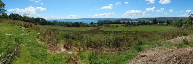
Image: © Lairich Rig Taken: 9 Jul 2014
This is a wide-angle view from the Image The Rosneath Peninsula juts in from the right, with the entrance to the Gareloch on its near side, and the Firth of Clyde behind. In the leftmost visible part of the Firth is Ardmore Point, easier to see with larger image sizes.
Images are licensed for reuse under creativecommons.org/licenses/by-sa/2.0
Image Location
Latitude
56.021649
Longitude
-4.764805