Former hunting standing, Nazeing
Introduction
The photograph on this page of Former hunting standing, Nazeing by Bikeboy as part of the Geograph project.
The Geograph project started in 2005 with the aim of publishing, organising and preserving representative images for every square kilometre of Great Britain, Ireland and the Isle of Man.

There are currently over 7.5m images from over 14,400 individuals and you can help contribute to the project by visiting https://www.geograph.org.uk
Former hunting standing, Nazeing
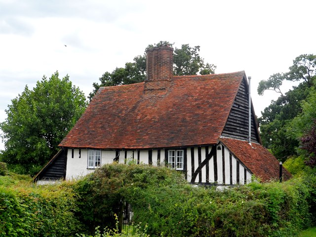
Image: © Bikeboy Taken: 16 Aug 2014
This timber-framed, plastered structure was built in 1542 as a hunting standing (somewhere to view a hunt from). As such it is situated so that it commands extensive views of the local area. The lean-to structures at each end are later additions. The chimney stack is late C16. See http://www.britishlistedbuildings.co.uk/en-118746-old-house-nazeing-essex for details.
Images are licensed for reuse under creativecommons.org/licenses/by-sa/2.0
Image Location
Latitude
51.736847
Longitude
0.052155