
The Citadel
Introduction
The photograph on this page of The Citadel by Bill Harrison as part of the Geograph project.
The Geograph project started in 2005 with the aim of publishing, organising and preserving representative images for every square kilometre of Great Britain, Ireland and the Isle of Man.

There are currently over 7.5m images from over 14,400 individuals and you can help contribute to the project by visiting https://www.geograph.org.uk
The Citadel
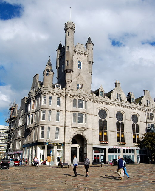
Image: © Bill Harrison Taken: 16 Aug 2014
The gigantic Salvation Army Citadel in the Castlegate built at enormous cost and dating from ca. 1895; B-listed: http://www.britishlistedbuildings.co.uk/sc-19996-25-30-inclusive-nos-castle-street-3-castl . The initial designs were rejected by the City as not befitting the site, so the revised plans in uber-Scottish Baronial style with a colossal tower, corner turrets and bartizans (fake battlements) were based on Balmoral. Parts of the building have been sold off for offices, but the Salvation Army is still very active.
Images are licensed for reuse under creativecommons.org/licenses/by-sa/2.0
Image Location

Latitude
57.148271
Longitude
-2.092037