Rotor bungalow
Introduction
The photograph on this page of Rotor bungalow by Noel Jenkins as part of the Geograph project.
The Geograph project started in 2005 with the aim of publishing, organising and preserving representative images for every square kilometre of Great Britain, Ireland and the Isle of Man.

There are currently over 7.5m images from over 14,400 individuals and you can help contribute to the project by visiting https://www.geograph.org.uk
Rotor bungalow
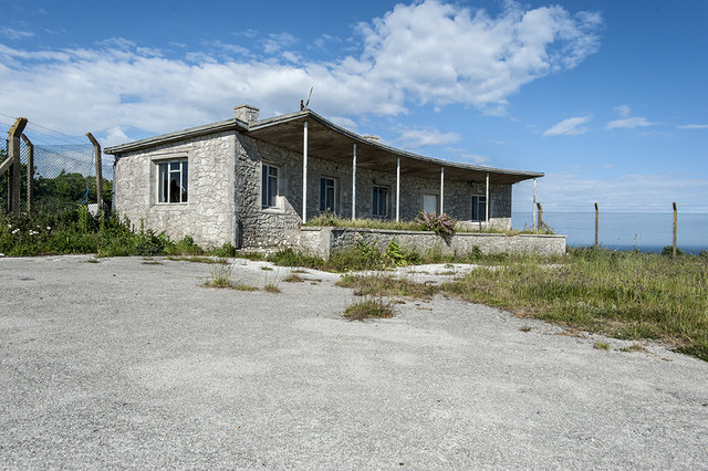
Image: © Noel Jenkins Taken: Unknown
For those seeking the truth behind the many rumours of hidden passages and bunkers on the Isle of Portland this unassuming bungalow may hold the answer. Inside is a (securely sealed) entrance to a ROTOR bunker that lies 100 feet below ground level. Access is not currently possible. More on ROTOR: http://www.subbrit.org.uk/rsg/features/rotor/
Images are licensed for reuse under creativecommons.org/licenses/by-sa/2.0
Image Location
Latitude
50.559661
Longitude
-2.431734