Alexandra Road
Introduction
The photograph on this page of Alexandra Road by Ian Capper as part of the Geograph project.
The Geograph project started in 2005 with the aim of publishing, organising and preserving representative images for every square kilometre of Great Britain, Ireland and the Isle of Man.

There are currently over 7.5m images from over 14,400 individuals and you can help contribute to the project by visiting https://www.geograph.org.uk
Alexandra Road
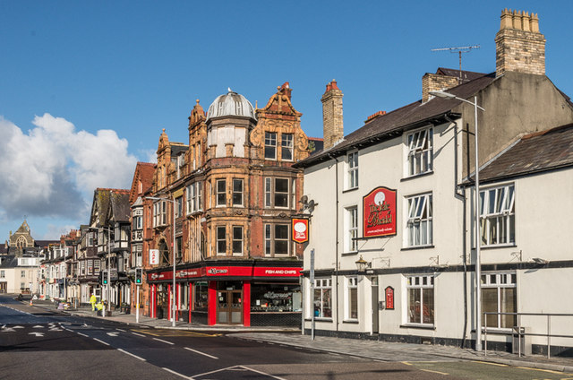
Image: © Ian Capper Taken: 8 Jul 2014
On the right is the Vale of Rheidol pub, originally called the Terminus Vaults or Terminus Hotel, which dated back to at least 1868. On the opposite corner is 2 Terrace Road (see Image). In the far distance is St Mary's Church.
Images are licensed for reuse under creativecommons.org/licenses/by-sa/2.0
Image Location


Leaflet Map data © OpenStreetMap
Latitude
52.414375
Longitude
-4.081924