Ascending the Wolverhampton flight
Introduction
The photograph on this page of Ascending the Wolverhampton flight by Stephen McKay as part of the Geograph project.
The Geograph project started in 2005 with the aim of publishing, organising and preserving representative images for every square kilometre of Great Britain, Ireland and the Isle of Man.

There are currently over 7.5m images from over 14,400 individuals and you can help contribute to the project by visiting https://www.geograph.org.uk
Ascending the Wolverhampton flight
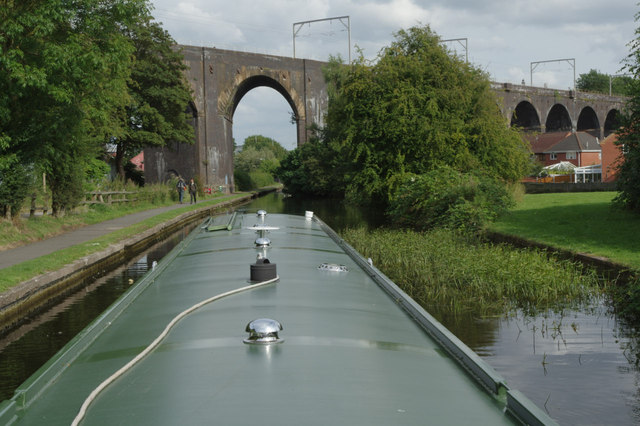
Image: © Stephen McKay Taken: 7 Aug 2014
The flight of 21 locks from Aldersley Junction to Broad Street Basin in Wolverhampton is generally unrelenting, but the locks are more spread out towards the bottom. There is a fairly long gap between locks 16 and 17, crossed by a railway viaduct; in this view a narrowboat has just emerged from lock 17 on its way up.
Images are licensed for reuse under creativecommons.org/licenses/by-sa/2.0
Image Location
Latitude
52.603379
Longitude
-2.134618