South side of gate pillars on a path to Forde House, Newton Abbot
Introduction
The photograph on this page of South side of gate pillars on a path to Forde House, Newton Abbot by Robin Stott as part of the Geograph project.
The Geograph project started in 2005 with the aim of publishing, organising and preserving representative images for every square kilometre of Great Britain, Ireland and the Isle of Man.

There are currently over 7.5m images from over 14,400 individuals and you can help contribute to the project by visiting https://www.geograph.org.uk
South side of gate pillars on a path to Forde House, Newton Abbot
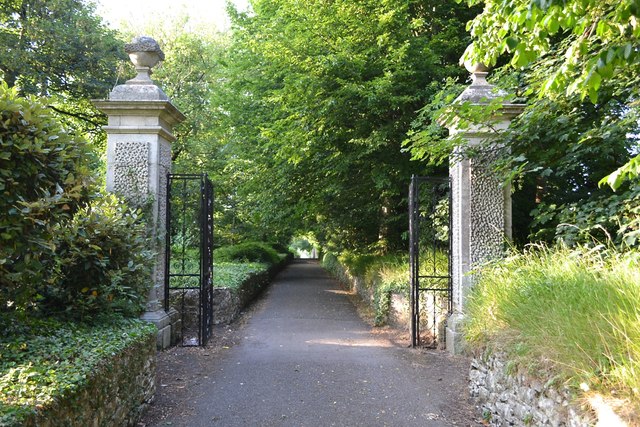
Image: © Robin Stott Taken: 7 Jul 2013
Low sun on a warm summer's evening picks out the vermiculated panels on the faces of the pillars. Listed Grade II, listing no.1256758, which starts: "Pair of gate piers and gates to Forde House. Early C18. Limestone ashlar piers approx 4m high, double wrought-iron gates approx 2.5m high." Forde House itself is listed Grade I, listing no.1256796. A small notice behind the camera states: "Teignbridge District Council / Forde House Offices / You are welcome to use this footpath which forms part of Forde House Offices complex but The Council does not intend it to be dedicated as a public right of way." This casts an unnecessary legalistic shadow over a beautiful walk. Tagged as 'grounds' since it would appear not to be public open space, despite informal access being possible.
Images are licensed for reuse under creativecommons.org/licenses/by-sa/2.0
Image Location
Latitude
50.526196
Longitude
-3.596964