Ruckford Mill
Introduction
The photograph on this page of Ruckford Mill by Simon Carey as part of the Geograph project.
The Geograph project started in 2005 with the aim of publishing, organising and preserving representative images for every square kilometre of Great Britain, Ireland and the Isle of Man.

There are currently over 7.5m images from over 14,400 individuals and you can help contribute to the project by visiting https://www.geograph.org.uk
Ruckford Mill
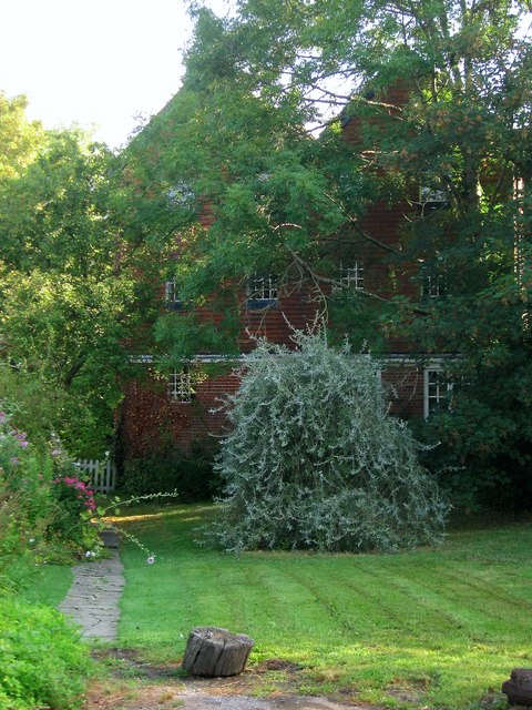
Image: © Simon Carey Taken: 7 Aug 2014
Mostly obscured by the trees in front of it. There has been a mill here since at least medieval times and may have been one of three in the parish of Hurstpierpoint mentioned in the Domesday book. The current building dates back to the 19th century and was sometimes known as Avery's Mill after the family who owned it. The mill seems to have been operation until the 1960s, similar to neighbouring Cobb's Mill, and has since been converted into a residence. Out of shot to the left are Image
Images are licensed for reuse under creativecommons.org/licenses/by-sa/2.0
Image Location
Latitude
50.946761
Longitude
-0.160504