Farm track and railway trackbed near Botolph Claydon
Introduction
The photograph on this page of Farm track and railway trackbed near Botolph Claydon by Andy Gryce as part of the Geograph project.
The Geograph project started in 2005 with the aim of publishing, organising and preserving representative images for every square kilometre of Great Britain, Ireland and the Isle of Man.

There are currently over 7.5m images from over 14,400 individuals and you can help contribute to the project by visiting https://www.geograph.org.uk
Farm track and railway trackbed near Botolph Claydon
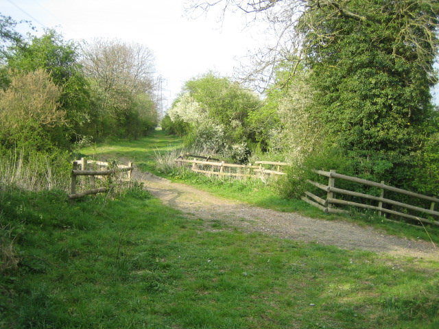
Image: © Andy Gryce Taken: 22 Apr 2007
The farm track crossing left to right is over a culvert of a stream that flows north to join Claydon Brook. The path in the direction of the camera is the trackbed of the Aylesbury & Buckingham Railway built in the 1860s and which ran from Quainton Road station to Verney Junction, which is 7km to the north. The line was initially worked by the GWR, then the Metropolitan Railway. In 1933 it became part of London Transport, but passenger services ended in 1936 and the line was made single track. The line was closed and lifted in 1956.
Images are licensed for reuse under creativecommons.org/licenses/by-sa/2.0
Image Location
Latitude
51.906522
Longitude
-0.920216