Ten Acres/Flat Mead
Introduction
The photograph on this page of Ten Acres/Flat Mead by Simon Carey as part of the Geograph project.
The Geograph project started in 2005 with the aim of publishing, organising and preserving representative images for every square kilometre of Great Britain, Ireland and the Isle of Man.

There are currently over 7.5m images from over 14,400 individuals and you can help contribute to the project by visiting https://www.geograph.org.uk
Ten Acres/Flat Mead
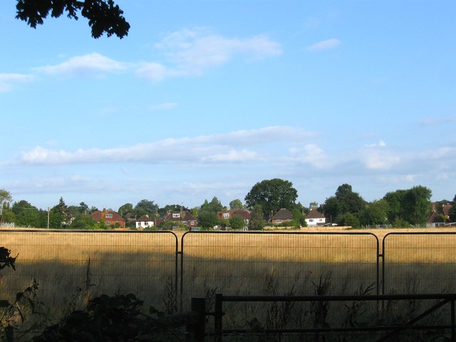
Image: © Simon Carey Taken: 7 Aug 2014
The name of the fields according to Hurstpierpoint's 1842 tithe map that have been joined together to make a larger unit. Ten Acres occupied the south east corner of the current field whilst Flat Mead made up the rest. This view is from Belmont Lane and is also fenced off like Image which suggests future development. The houses at the far end of the field front onto College Lane.
Images are licensed for reuse under creativecommons.org/licenses/by-sa/2.0
Image Location
Latitude
50.928615
Longitude
-0.161789