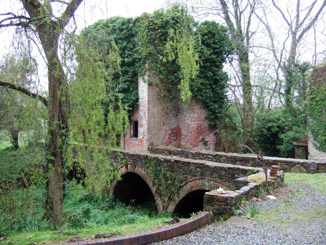
Prendergast mill ruins
Introduction
The photograph on this page of Prendergast mill ruins by Natasha Ceridwen de Chroustchoff as part of the Geograph project.
The Geograph project started in 2005 with the aim of publishing, organising and preserving representative images for every square kilometre of Great Britain, Ireland and the Isle of Man.
There are currently over 7.5m images from over 14,400 individuals and you can help contribute to the project by visiting https://www.geograph.org.uk

Image: © Natasha Ceridwen de Chroustchoff Taken: 23 Apr 2007
On a mission to Geograph this square I was amazed to come upon these sizable ruins of an old mill. The bridge and some of the building are stone, the brick structure is perhaps a later addition. There is no water course here now but the Western Cleddau flows only yards away and would no doubt have provided the supply. It was a cotton mill around 1786, the largest textile mill in S. Wales then, with over 1500 spindles. It was converted to a paper mill in 1816 and Haverfordwest was noted for its paper at that time. A large mill house, not ruined, is on the photographer's right.

