Hawarden Castle Hotel, Queensferry
Introduction
The photograph on this page of Hawarden Castle Hotel, Queensferry by John S Turner as part of the Geograph project.
The Geograph project started in 2005 with the aim of publishing, organising and preserving representative images for every square kilometre of Great Britain, Ireland and the Isle of Man.

There are currently over 7.5m images from over 14,400 individuals and you can help contribute to the project by visiting https://www.geograph.org.uk
Hawarden Castle Hotel, Queensferry
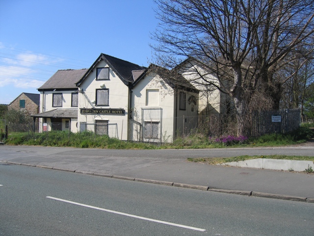
Image: © John S Turner Taken: 11 Apr 2007
The Hawarden Castle Hotel is nowhere near Hawarden Castle, but it is a stylish name for a hostelry, which would have been busy in 1882 when it is shown on the O.S. map close to the Queen's Ferry (free). This was at a time before any bridges had been built over the River Dee downstream of Chester. The hotel is now closed and no one stops here any more. The road in front of the camera is the one that crosses the blue bascule bridge, which is just out of sight to the right, and the angled road across the front of the hotel is the road for the first bridge that pre-dated the blue one. That first bridge has been demolished.
Images are licensed for reuse under creativecommons.org/licenses/by-sa/2.0
Image Location
Latitude
53.209928
Longitude
-3.018147