
An Easter Walk in the Conwy Valley - 25
Introduction
The photograph on this page of An Easter Walk in the Conwy Valley - 25 by Alan Walker as part of the Geograph project.
The Geograph project started in 2005 with the aim of publishing, organising and preserving representative images for every square kilometre of Great Britain, Ireland and the Isle of Man.

There are currently over 7.5m images from over 14,400 individuals and you can help contribute to the project by visiting https://www.geograph.org.uk
An Easter Walk in the Conwy Valley - 25
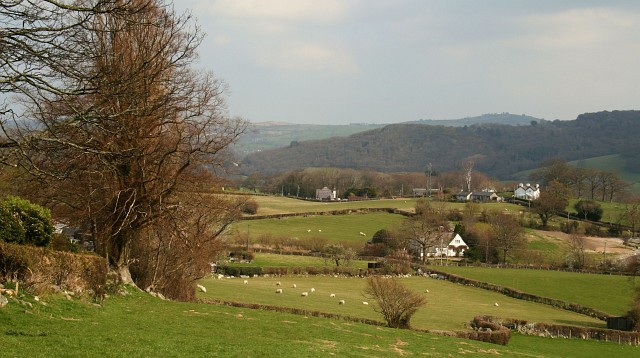
Image: © Alan Walker Taken: 8 Apr 2007
This photograph of farmland in the Conwy Valley was taken from a public footpath on a circular walk that leads from St Mary, Caer Rhun to Ty’n-y-groes and back via Pontwgan. From behind this viewpoint at Cefn Isaf http://www.multimap.com/map/browse.cgi?lat=53.2238&lon=-3.8477&scale=25000&icon=x until the public footpath reaches the road at Pontwgan http://www.multimap.com/map/browse.cgi?lat=53.2209&lon=-3.8487&scale=25000&icon=x (a distance of about one kilometre) the walker will need to be careful as to the route they take because, although it is way-marked all the markers are facing the opposite direction! Also, note on the map how the path takes a right-hand bend http://www.multimap.com/map/browse.cgi?lat=53.2212&lon=-3.8477&scale=25000&icon=x from a southerly direction to a westerly direction before the road is reached. When the road is reached turn left (easterly) and then, almost immediately right (southerly) to cross a bridge over the Afon Roe. Follow the road for some 100metres and then take the public footpath http://www.multimap.com/map/browse.cgi?lat=53.2196&lon=-3.8489&scale=25000&icon=x on the left (easterly) into the field. To see the next photograph on this walk, click here Image To see the previous photograph on the walk, click here Image To go to the start of the walk, click here Image
Images are licensed for reuse under creativecommons.org/licenses/by-sa/2.0
Image Location

Latitude
53.222333
Longitude
-3.847817