St Mary the Virgin Church, East Claydon
Introduction
The photograph on this page of St Mary the Virgin Church, East Claydon by Andy Gryce as part of the Geograph project.
The Geograph project started in 2005 with the aim of publishing, organising and preserving representative images for every square kilometre of Great Britain, Ireland and the Isle of Man.

There are currently over 7.5m images from over 14,400 individuals and you can help contribute to the project by visiting https://www.geograph.org.uk
St Mary the Virgin Church, East Claydon
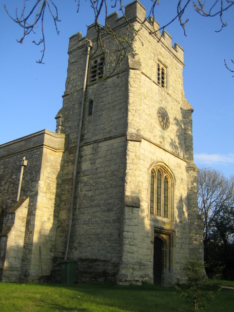
Image: © Andy Gryce Taken: 22 Apr 2007
This is the parish church of East Claydon which is on top of Sion Hill on the eastern edge of the village at a height of 120m. The earliest part of the church at the beginning of the 13th century was an aisle-less nave and chancel, and the first rector was recorded as Richard Hanley in 1218. The tower was added in the late 15th or early 16th century. The church is said to have been damaged by Cromwell's men in the Civil War, and was only completely restored by Sir Gilbert Scott in 1871. In 1976 the parishes of East, Middle and Steeple Claydon were united, each with its own parish church, to become the Parish of the Claydons. The name Claydon derives from the old english clægig + dun and means 'clayey hill', and Claindone is the name given for Claydon in the Domesday Book in 1086.
Images are licensed for reuse under creativecommons.org/licenses/by-sa/2.0
Image Location
Latitude
51.923386
Longitude
-0.925774