The Annalong Orange Arch, 2014
Introduction
The photograph on this page of The Annalong Orange Arch, 2014 by Eric Jones as part of the Geograph project.
The Geograph project started in 2005 with the aim of publishing, organising and preserving representative images for every square kilometre of Great Britain, Ireland and the Isle of Man.

There are currently over 7.5m images from over 14,400 individuals and you can help contribute to the project by visiting https://www.geograph.org.uk
The Annalong Orange Arch, 2014
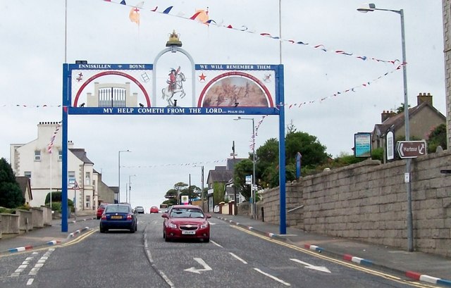
Image: © Eric Jones Taken: 30 Jul 2014
As is traditional, Annalong's Orange Arch is again this year erected in front of the village's Presbyterian Church. It bears the traditional symbols of the Loyal Orange Institution.
Images are licensed for reuse under creativecommons.org/licenses/by-sa/2.0
Image Location
Latitude
54.108099
Longitude
-5.900704