West Marton
Introduction
The photograph on this page of West Marton by David Dixon as part of the Geograph project.
The Geograph project started in 2005 with the aim of publishing, organising and preserving representative images for every square kilometre of Great Britain, Ireland and the Isle of Man.

There are currently over 7.5m images from over 14,400 individuals and you can help contribute to the project by visiting https://www.geograph.org.uk
West Marton
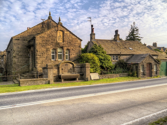
Image: © David Dixon Taken: 26 Jul 2014
Two interesting buildings on the A59, Gisburn Road at the West Marton crossroads. The larger building, nearest to the corner has the initials RFR and the date 1884 together with a sword carved on the stonework on the gable end (Image]). The other, smaller building has the same initials and the date 1889 on the lintel above the doorway. I'm not sure what their original purpose was, but the larger one *may* have been the village institute http://oneguyfrombarlick.co.uk/viewtopic.php?f=360&t=9071 . The stone trough is dated 1887 to commemorate Queen Victoria's golden jubilee year.
Images are licensed for reuse under creativecommons.org/licenses/by-sa/2.0
Image Location
Latitude
53.949948
Longitude
-2.163761