The Modern Queensferry Road Bridge
Introduction
The photograph on this page of The Modern Queensferry Road Bridge by John S Turner as part of the Geograph project.
The Geograph project started in 2005 with the aim of publishing, organising and preserving representative images for every square kilometre of Great Britain, Ireland and the Isle of Man.

There are currently over 7.5m images from over 14,400 individuals and you can help contribute to the project by visiting https://www.geograph.org.uk
The Modern Queensferry Road Bridge
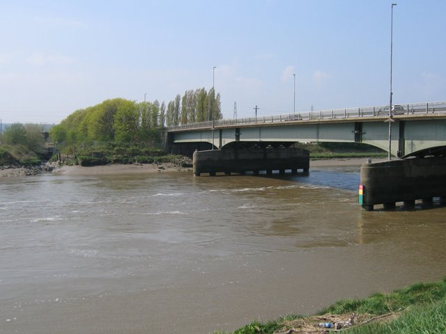
Image: © John S Turner Taken: 20 Apr 2007
This view of the modern Queensferry road bridge is from the cycleway between Chester and Queensferry. The tidal bore has just passed and the tide is running strongly upstream to the left against the river flow.
Images are licensed for reuse under creativecommons.org/licenses/by-sa/2.0
Image Location
Latitude
53.209963
Longitude
-3.013955