
Llanfairpwllgwyngyllgogerychwyrndrobwllllantysiliogogogoch station
Introduction
The photograph on this page of Llanfairpwllgwyngyllgogerychwyrndrobwllllantysiliogogogoch station by Chris Morgan as part of the Geograph project.
The Geograph project started in 2005 with the aim of publishing, organising and preserving representative images for every square kilometre of Great Britain, Ireland and the Isle of Man.

There are currently over 7.5m images from over 14,400 individuals and you can help contribute to the project by visiting https://www.geograph.org.uk
Llanfairpwllgwyngyllgogerychwyrndrobwllllantysiliogogogoch station
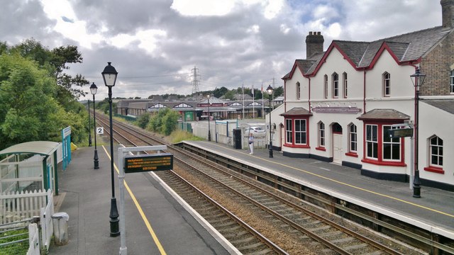
Image: © Chris Morgan Taken: 20 Jul 2014
Looking towards the west. The longest station name in Britain, the village name means, "St Mary's church in the hollow of the white hazel near to the fierce whirlpool and the church of St Tysilio of the red cave" although it was only Llanfairpwllgwyngyll until the 1860s and was revised to encourage tourism - which it still does. The station isn't what it was when it probably made more money from selling platform tickets than tickets for travel from here!
Images are licensed for reuse under creativecommons.org/licenses/by-sa/2.0
Image Location

Latitude
53.221132
Longitude
-4.213569