Clydach tunnels
Introduction
The photograph on this page of Clydach tunnels by Alan Bowring as part of the Geograph project.
The Geograph project started in 2005 with the aim of publishing, organising and preserving representative images for every square kilometre of Great Britain, Ireland and the Isle of Man.

There are currently over 7.5m images from over 14,400 individuals and you can help contribute to the project by visiting https://www.geograph.org.uk
Clydach tunnels
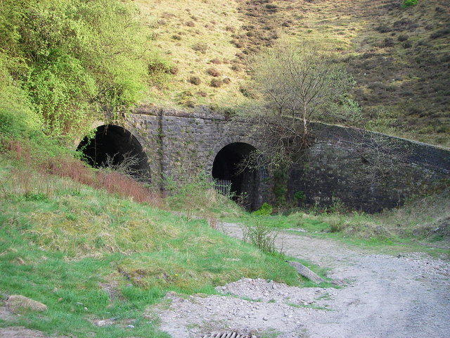
Image: © Alan Bowring Taken: 21 Apr 2007
The twin entrances to the tunnels under Gellifelen on the former railway running down (up?) the Clydach Gorge between Abergavenny and Brymawr. The National Cycle Network route 46 skirts the hill to the left to avoid passing through the tunnels.
Images are licensed for reuse under creativecommons.org/licenses/by-sa/2.0
Image Location
Latitude
51.802281
Longitude
-3.139851