Erection of flats, Dental Street
Introduction
The photograph on this page of Erection of flats, Dental Street by John Baker as part of the Geograph project.
The Geograph project started in 2005 with the aim of publishing, organising and preserving representative images for every square kilometre of Great Britain, Ireland and the Isle of Man.

There are currently over 7.5m images from over 14,400 individuals and you can help contribute to the project by visiting https://www.geograph.org.uk
Erection of flats, Dental Street
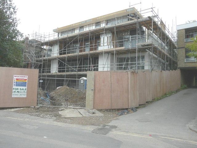
Image: © John Baker Taken: 20 Jul 2014
Planning permission has been approved, with conditions, by Folkestone and Hythe District Council under application number Y/13/0068/NMC for the “non-material change to applicationY13/0481/SH - erection of a four storey block of eight flats following demolition of the existing building” The existing building referred to in the application was a bungalow called Springfield, after which the flats have been named ie Image
Images are licensed for reuse under creativecommons.org/licenses/by-sa/2.0
Image Location
Latitude
51.072525
Longitude
1.087478