Binscombe Farm
Introduction
The photograph on this page of Binscombe Farm by Stefan Czapski as part of the Geograph project.
The Geograph project started in 2005 with the aim of publishing, organising and preserving representative images for every square kilometre of Great Britain, Ireland and the Isle of Man.

There are currently over 7.5m images from over 14,400 individuals and you can help contribute to the project by visiting https://www.geograph.org.uk
Binscombe Farm
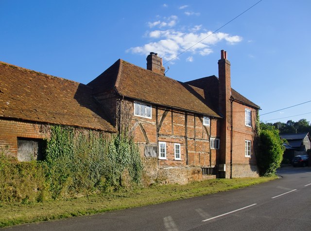
Image: © Stefan Czapski Taken: 29 Jul 2014
The oldest part of the house is timber-framed with brick in-fill ('nogging') - a form of construction that must once have been very widespread in Surrey, particularly in areas where building stone was hard to come by. Some examples of brick-nogging in other parts of Surrey: at Limpsfield http://www.geograph.org.uk/photo/3050766 at Ockley: http://www.geograph.org.uk/photo/2177402
Images are licensed for reuse under creativecommons.org/licenses/by-sa/2.0
Image Location
Latitude
51.205127
Longitude
-0.617334