Willoughby Farm House
Introduction
The photograph on this page of Willoughby Farm House by Alan Murray-Rust as part of the Geograph project.
The Geograph project started in 2005 with the aim of publishing, organising and preserving representative images for every square kilometre of Great Britain, Ireland and the Isle of Man.

There are currently over 7.5m images from over 14,400 individuals and you can help contribute to the project by visiting https://www.geograph.org.uk
Willoughby Farm House
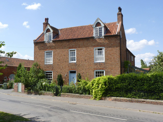
Image: © Alan Murray-Rust Taken: 24 Jul 2014
Early 19th century 3-bay brick farmhouse. The dormers date from later in the same century. Listed Grade II. The listing specifically includes the boundary wall in front of the house with its cast iron gate and railings. .
Images are licensed for reuse under creativecommons.org/licenses/by-sa/2.0
Image Location
Latitude
53.147752
Longitude
-0.846581