The Lion o' Morfe, Upper Farmcote, Shropshire
Introduction
The photograph on this page of The Lion o' Morfe, Upper Farmcote, Shropshire by Roger Kidd as part of the Geograph project.
The Geograph project started in 2005 with the aim of publishing, organising and preserving representative images for every square kilometre of Great Britain, Ireland and the Isle of Man.

There are currently over 7.5m images from over 14,400 individuals and you can help contribute to the project by visiting https://www.geograph.org.uk
The Lion o' Morfe, Upper Farmcote, Shropshire
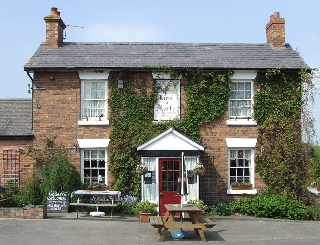
Image: © Roger Kidd Taken: 20 Apr 2007
Front view of this real ale pub (not open every weekday lunchtime). The Lion o' Morfe became a country pub in the 1850s. Morfe is from the Welsh name meaning marsh. Update: 2022. Opening daily 12:00-23:00.
Images are licensed for reuse under creativecommons.org/licenses/by-sa/2.0
Image Location
Latitude
52.524665
Longitude
-2.340134