Former Methodist Chapel
Introduction
The photograph on this page of Former Methodist Chapel by Anne Burgess as part of the Geograph project.
The Geograph project started in 2005 with the aim of publishing, organising and preserving representative images for every square kilometre of Great Britain, Ireland and the Isle of Man.

There are currently over 7.5m images from over 14,400 individuals and you can help contribute to the project by visiting https://www.geograph.org.uk
Former Methodist Chapel
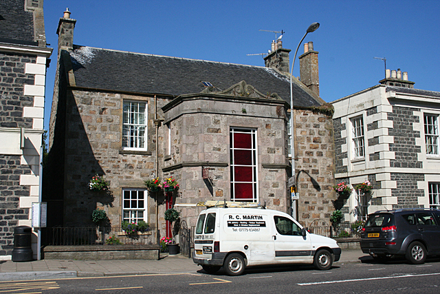
Image: © Anne Burgess Taken: 25 Jul 2014
This is No 27 Castle Street. The original house dates from the 1820s, but in the 1860s the first floor had been converted to a Wesleyan Methodist chapel, and the projecting stair added at the front.
Images are licensed for reuse under creativecommons.org/licenses/by-sa/2.0
Image Location
Latitude
57.666416
Longitude
-2.523794