Beaconsfield: Railway towards Beaconsfield station
Introduction
The photograph on this page of Beaconsfield: Railway towards Beaconsfield station by Nigel Cox as part of the Geograph project.
The Geograph project started in 2005 with the aim of publishing, organising and preserving representative images for every square kilometre of Great Britain, Ireland and the Isle of Man.

There are currently over 7.5m images from over 14,400 individuals and you can help contribute to the project by visiting https://www.geograph.org.uk
Beaconsfield: Railway towards Beaconsfield station
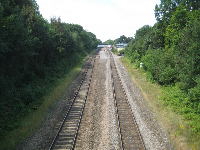
Image: © Nigel Cox Taken: 26 Jul 2014
The Great Western and Great Central Joint Railway opened their line through Beaconsfield in 1906, and as can be seen from this and other photographs of the railway in the vicinity it involved the excavation of a long cutting. This is the view looking westwards and "down" towards the station at Beaconsfield, from the footbridge that now links Caledon Road and Maxwell Road. Ironically the footpath predates both the railway and the roads, and presumably the railway company had to build the bridge to maintain the public right of way. The photograph clearly shows the gap where the original through non-stop lines ran, until they were lifted by British Rail in 1974. For a view in the opposite direction please see Image
Images are licensed for reuse under creativecommons.org/licenses/by-sa/2.0
Image Location
Latitude
51.611324
Longitude
-0.642146