View from Binney Road
Introduction
The photograph on this page of View from Binney Road by Marathon as part of the Geograph project.
The Geograph project started in 2005 with the aim of publishing, organising and preserving representative images for every square kilometre of Great Britain, Ireland and the Isle of Man.

There are currently over 7.5m images from over 14,400 individuals and you can help contribute to the project by visiting https://www.geograph.org.uk
View from Binney Road
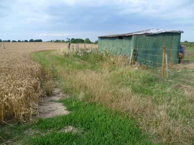
Image: © Marathon Taken: 26 Jul 2014
This is the view from Binney Road which leads from Allhallows to Binney Farm and Allhallows Marshes. There are a number of horse paddocks in this immediate area. On either side of the corrugated iron shelter for horses can be seen the embankment of the former branch railway line from Stoke Junction to Allhallows-on-Sea station. The latter was roughly where the buildings in the distance can be seen. The railway was a very short-lived affair. It was opened on 16th May 1932 by the Southern Railway in an effort to develop a seaside resort at Allhallows on Sea. A station hotel was built but the rather bleak location could never compete with other resorts and although the branch was doubled in 1935, it always struggled. After the Second World War there was a steady decline in passengers and the line was singled again in 1957. It finally closed on 4th December 1961. See http://www.disused-stations.org.uk/a/allhallows_on_sea/ for a fuller history of the branch.
Images are licensed for reuse under creativecommons.org/licenses/by-sa/2.0
Image Location
Latitude
51.468058
Longitude
0.652596