Vallum and Military Road near High Shield
Introduction
The photograph on this page of Vallum and Military Road near High Shield by Phil Champion as part of the Geograph project.
The Geograph project started in 2005 with the aim of publishing, organising and preserving representative images for every square kilometre of Great Britain, Ireland and the Isle of Man.

There are currently over 7.5m images from over 14,400 individuals and you can help contribute to the project by visiting https://www.geograph.org.uk
Vallum and Military Road near High Shield
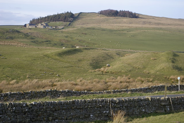
Image: © Phil Champion Taken: 8 Apr 2007
The mounds and ditches in the centre of the photo are the remains of the Vallum, which runs to the south of Hadrian's Wall. To the west of this point the 18th century Military Road (modern B6318) was built over the line of the Vallum. Hadrian's Wall itself can be seen descending the hill side to the right of the plantation, and the farm at Hotbank.
Images are licensed for reuse under creativecommons.org/licenses/by-sa/2.0
Image Location
Latitude
55.000636
Longitude
-2.361081