Railway line & former railway junction
Introduction
The photograph on this page of Railway line & former railway junction by Andy Gryce as part of the Geograph project.
The Geograph project started in 2005 with the aim of publishing, organising and preserving representative images for every square kilometre of Great Britain, Ireland and the Isle of Man.

There are currently over 7.5m images from over 14,400 individuals and you can help contribute to the project by visiting https://www.geograph.org.uk
Railway line & former railway junction
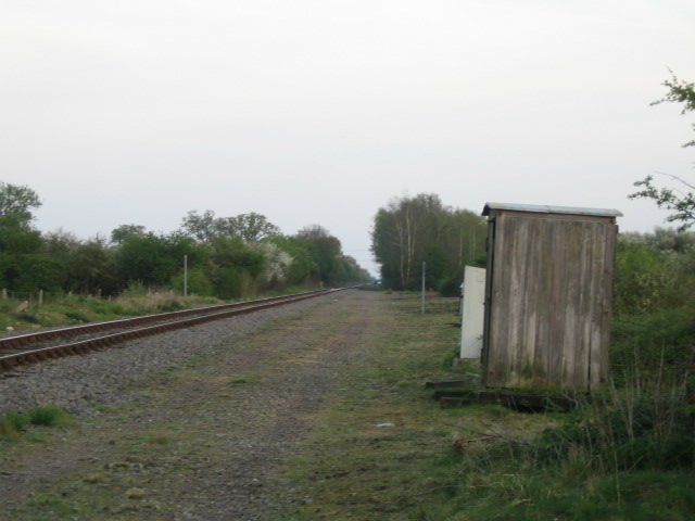
Image: © Andy Gryce Taken: 21 Apr 2007
This photograph marks the site of Grendon Underwood Junction, and the railway line was once part of the Great Central Railway, which when it opened in 1899 was the last main line twin track railway to be built. The line ran between Sheffield, Nottingham and London Marylebone, see http://www.railwayarchive.org.uk/index.php. Much of the line was closed in 1966, but this single track stretch between Claydon Junction, and Quainton Road, about 4km away in the direction of the picture, remains. It is used by four freight trains a day from Brentford in London carrying containerised household waste to the landfill site at Calvert just before Claydon Junction, see Image From this point, an alternative route to Marylebone via High Wycombe was constructed to avoid sharing the main line with the Metropolitan Railway via Aylesbury, but this was largely dismantled in the late 1960s, and only the trackbed can now be seen in this photo curving off to the right in the middle distance. Part of this line was still in use until the mid 90s by a weekly freight train to serve a fertiliser depot just north of the A41 near Woodham. Here is a photo from 1904 of this junction in much the same position as this photo with the alternative line to High Wycombe off to the right not yet complete, http://www.railwayarchive.org.uk/map/getobjectmap.php?rnum=L1647&mapid=469220.jpg&mlsref=1059&cmn=Grendon%20Underwood&pn=1&mp=1&all=no. The Grendon Underwood Junction signal box of 1904 contrasts with the sad little wooden hut on the other side of the line in 2007.
Images are licensed for reuse under creativecommons.org/licenses/by-sa/2.0
Image Location


Leaflet Map data © OpenStreetMap
Latitude
51.892955
Longitude
-0.971549