Sticil Llanyrnewydd Stile
Introduction
The photograph on this page of Sticil Llanyrnewydd Stile by Alan Richards as part of the Geograph project.
The Geograph project started in 2005 with the aim of publishing, organising and preserving representative images for every square kilometre of Great Britain, Ireland and the Isle of Man.

There are currently over 7.5m images from over 14,400 individuals and you can help contribute to the project by visiting https://www.geograph.org.uk
Sticil Llanyrnewydd Stile
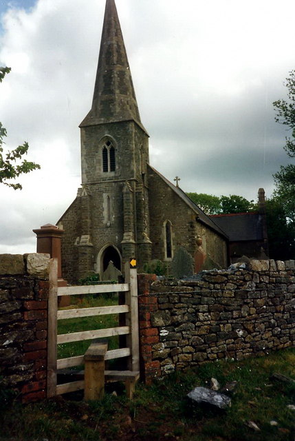
Image: © Alan Richards Taken: 2 Jun 1996
Sticil yn rhoi mynediad i Eglwys Llanyrnewydd. Ei henw gwreiddiol oedd Llanenewyr ac roedd yn gapel anwes i Lanrhidian. A stile giving access to Llanyrnewydd Church. Originally known as Llanenewyr (trans. St Enewyr's Church) it was formerly a chapel of ease belonging to Llanrhidian.
Images are licensed for reuse under creativecommons.org/licenses/by-sa/2.0
Image Location
Latitude
51.633225
Longitude
-4.098967