Neilston Parish Church
Introduction
The photograph on this page of Neilston Parish Church by Leslie Barrie as part of the Geograph project.
The Geograph project started in 2005 with the aim of publishing, organising and preserving representative images for every square kilometre of Great Britain, Ireland and the Isle of Man.

There are currently over 7.5m images from over 14,400 individuals and you can help contribute to the project by visiting https://www.geograph.org.uk
Neilston Parish Church
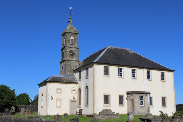
Image: © Leslie Barrie Taken: 9 Jul 2014
Category B-listed. Built c1762 incorporating part of the pre-Reformation church. Additions were made in 1798 and later.
Images are licensed for reuse under creativecommons.org/licenses/by-sa/2.0
Image Location
Latitude
55.785581
Longitude
-4.425515