Inverurie 1st railway station (site), Aberdeenshire, 2014
Introduction
The photograph on this page of Inverurie 1st railway station (site), Aberdeenshire, 2014 by Nigel Thompson as part of the Geograph project.
The Geograph project started in 2005 with the aim of publishing, organising and preserving representative images for every square kilometre of Great Britain, Ireland and the Isle of Man.

There are currently over 7.5m images from over 14,400 individuals and you can help contribute to the project by visiting https://www.geograph.org.uk
Inverurie 1st railway station (site), Aberdeenshire, 2014
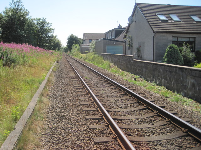
Image: © Nigel Thompson Taken: 25 Jul 2014
Opened in 1854 by the Great North of Scotland Railway on what is today the line from Aberdeen to Inverness, this station closed in 1902 when it was replaced by the current station, some 800 metres to the north. View south towards Kintore and Aberdeen from a public crossing. From old maps, it would appear to have had three platform faces with an island platform to the left and a further platform and main building to the right. No trace apparently remains. Five years after this image was taken, the line was redoubled again.
Images are licensed for reuse under creativecommons.org/licenses/by-sa/2.0
Image Location
Latitude
57.27999
Longitude
-2.369349